There have been posts in the past mentioning the GPS height on 4600/4625 radios is wildly inaccurate and since height is one of the 2 main factors in determining what TX power you are allowed in AFC it is very important to have that data accurrate.
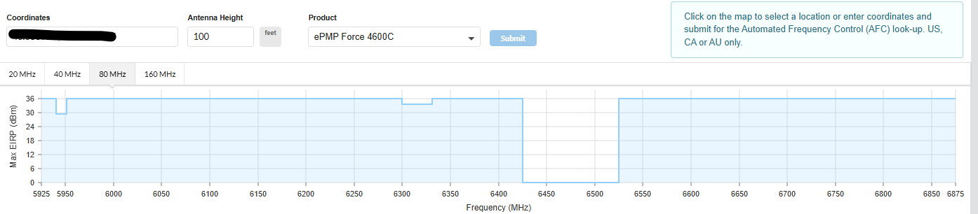
I still see issue with APs where the height reported by GPS seems to be way too high causing loss of AFC power on channels. For example I have an AP whose actual AGL height is around 85ft but have a GPS reported height of over 1000ft. I believe the GPS height include ASL+GPS height (AGL).
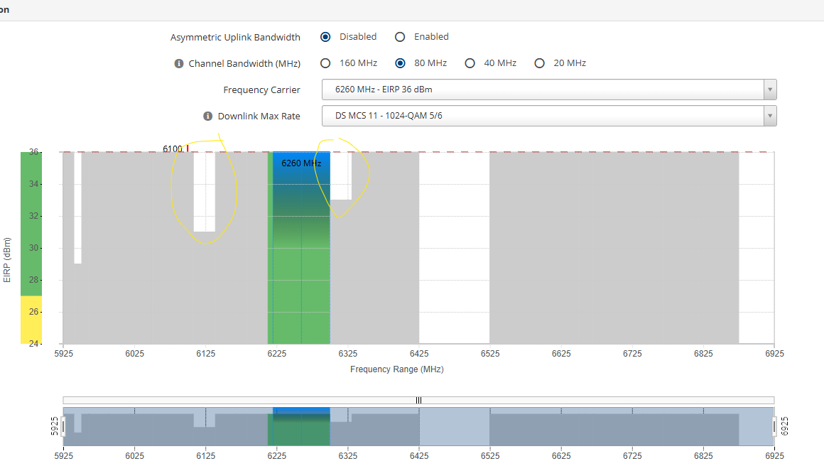
So what this causes is when I use the AFC tool in LinkPlanner for my tower and put in the actual height of the AP plus a buffer of 20-30ft extra I can use almost all channels at full power. However that is not what my AP shows I can use.
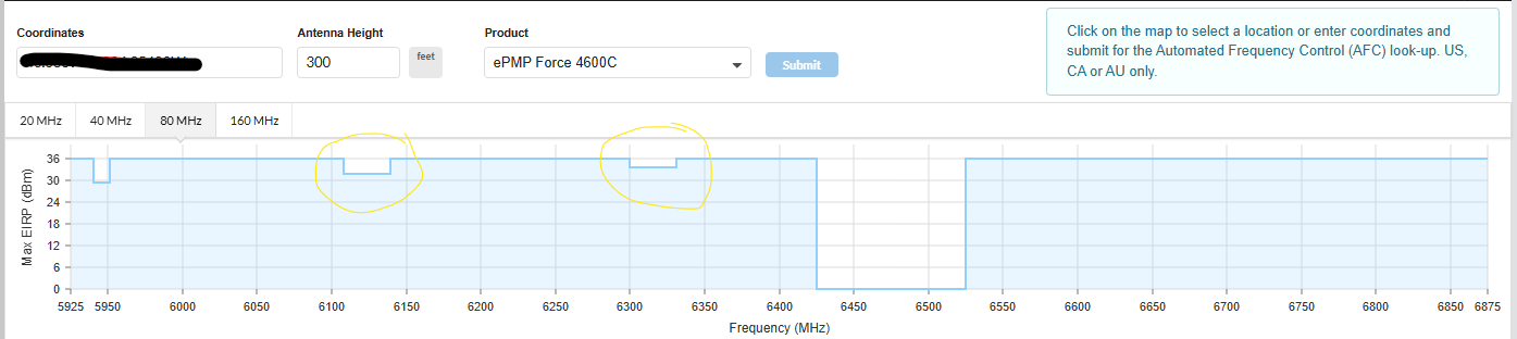
I have to increase to tower height in the LinkPlanner tool to 300ft for it to show what my AP AFC shows. To me this means the GPS height has a margin of error of around ~200ft.