The Export → Coverage (477/BDC) feature in cnHeat allows the user to generate polygon coverage maps.
To view the Geopackage or Shapefile (.zip) coverage polygons in QGIS please follow these instructions.
Setting up QGIS
-
Open QGIS. (For this walkthrough we are using QGIS 3.26.1.)
-
Confirm that your Coordinate Reference System (CRS) is to EPSG:4326:
-
Click the CRS in the bottom-right of the screen.

-
Select EPSG:4326 and click OK
-

Adding layers to QGIS
Note: cnHeat has four steps under the Export > Coverage (477/BDC) feature. Steps 3 and 4 offer the ability to download coverage polygons. Unzipping these files will present a .gpkg and a .zip (shapefile) of polygon coverage. These are identical. You can load either. The process is identical.
Load the cnHeat coverage polygon
-
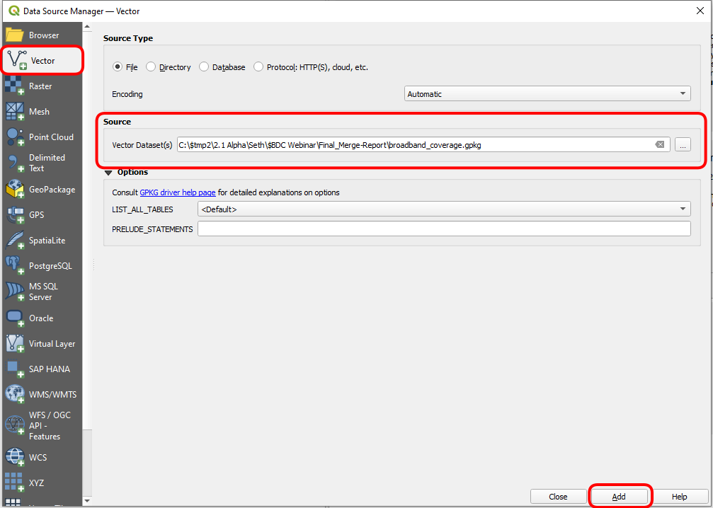
Open the Data Source Manager with either Ctrl+L or by clicking this icon in the toolbar:

-
Make sure Vector is selected from the left and load either the .gpkg file or the .zip (shapefile) from the zip file downloaded in Step 3 or 4 of the cnHeat Coverage Export tool.
-
Click Add.
-
Click Add Layers.

-
Click Close to close the Data Source Manager dialogue to be taken to the map view.
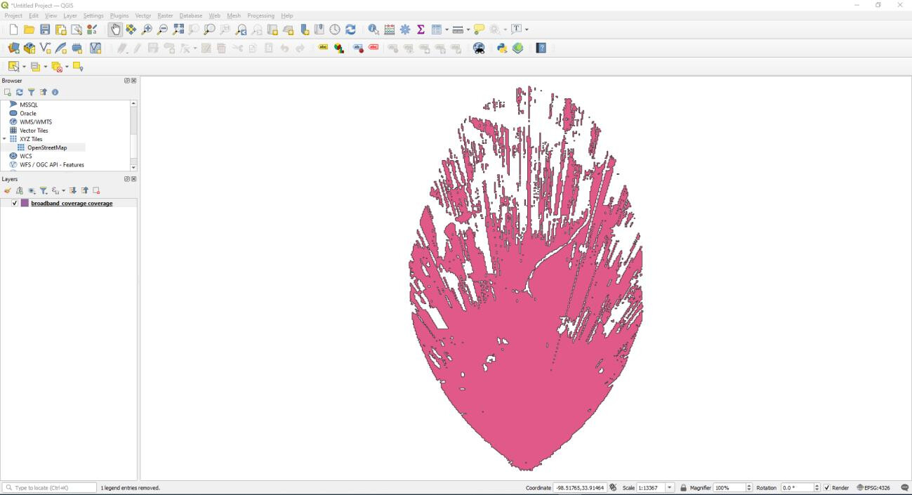
Results should look something like this:
Adding an OpenStreetMap layer
-
Under the browser dialogue on the left navigate to “XYZ Tiles”. Expand to show OpenStreetMap.
-
Right-click OpenStreetMap and select Add Layer to Project.
-
In the Layers window, left-click and drag the OpenStreetMap to the bottom of the list so that the
broadband_coverage displays on top of OpenStreetMaps.


Change Styling
-
To change the styling of a coverage layer, right-click on the layer in the Layers window and choose
Properties… -
Select Symbology. From here the Color and Opacity can be adjusted along with many other settings.

